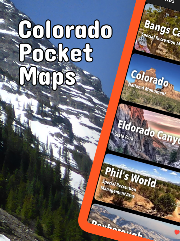
About Colorado Pocket Maps
Early Spring 2024: Be prepared for your adventure without Wi-Fi or mobile service! Download Colorado maps for national and state parks before you hike. Be prepared! Plan your next trip to one of the great Colorado parks....
Early Spring 2024: Be prepared for your adventure without Wi-Fi or mobile service! Download Colorado maps for national and state parks before you hike.
Be prepared! Plan your next trip to one of the great Colorado parks. Download maps and guides before you venture into the Wi-Fi free wilderness.
Discover
- 100+ national parks, state parks, monuments, forests
- 290+ neatly folded maps by the National Park Service, Bureau of Land Management, United States Forest Services, and other agencies.
- Motor Vehicle Use Maps (MVUM), Motor Vehicle Travel Maps (MVTM) and visitor maps for Colorado national forests.
- 3,000+ campgrounds and campsites
- 6,000+ trails and trailheads
- 64,000+ points of interests
Plan
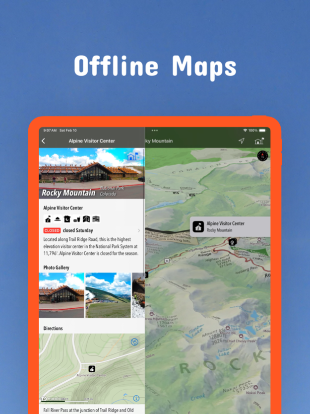
- Download maps, park brochures, and newspapers. These downloads are ready when you are offline and off the grid in the great outdoors.
- Download arbitrary map sections as offline packs.
- Photo galleries, panorama views.
- Share links to parks and maps with friends
Have fun
- GPS and GPX support: record your hikes, import GPX routes, tracks and waypoints for your hiking trails.
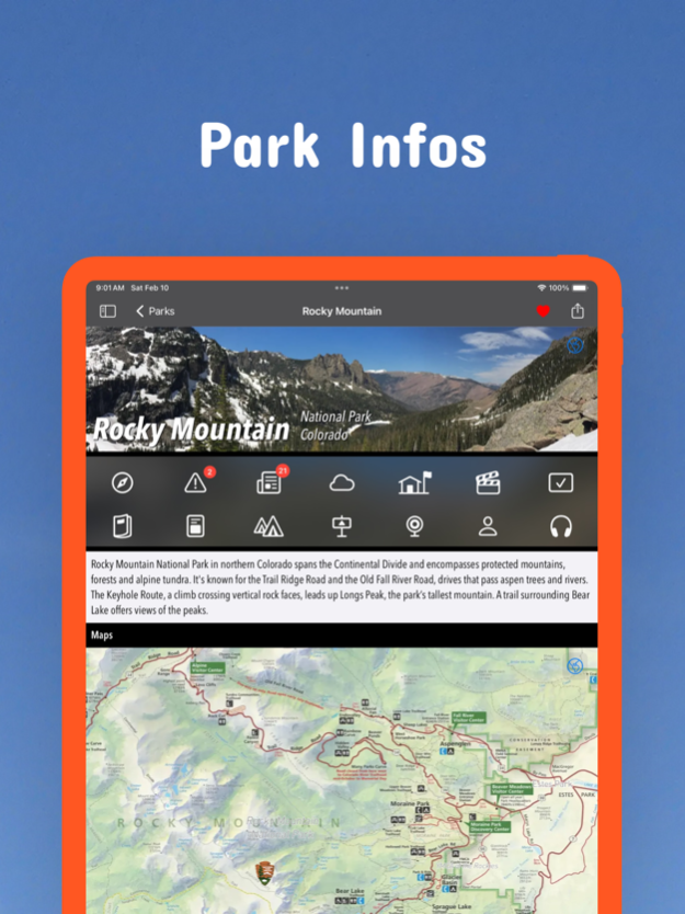
- Detailed national park information: alerts, news, visitor centers, campgrounds, driving directions, weather.
- Open your favorite maps app to get a route to the selected park.
- Current weather conditions, easy access to multi-day forecasts, sunrise and sunset times.
- Push notifications for park alerts, park news, weather warnings
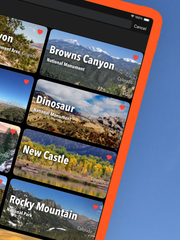
So download maps and guides for:
Arapaho
Arkansas Headwaters
Bangs Canyon
Barr Lake
Black Canyon of the Gunnison
Bocco Mountain
Boyed Lake
Browns Canyon
Bull Gulch
Canyons of the Ancients
Carbondale
Castlewood Canyon
Chatfield
Cherry Creek
Cheyenne Mountain
Colorado
Comanche
Crawford
Curecanti
Dinosaur
Dolores River
Dominguez-Escalante
Eagle
Eldorado Canyon
Eleven Mile
Elkhead Reservoir
Florissant Fossil Beds
Golden Gate Canyon
Grand Mesa
Great Sand Dunes
Gunnison Basin
Gunnison Gorge
Hack Lake
Highline Lake
Jackson Lake
James M. Robb - Colorado River
John Martin Reservoir
King Mountain
Lake Pueblo
Lathrop
Lory
Mancos
Montrose
McInnis Canyons
Mesa Verde
Mueller
Navajo
New Castle
North Sterlin
Pawnee
Perl Lake
Phil's World
Pike
Pisgah Mountain
Ridgway
Rifle Falls
Rio Grande
Rocky Mountain
Roosevelt
Routt
Roxborough
San Isabel
San Juan
San Luis Valley
St. Vrain
Stagecoach
State Forest
Staunton
Steamboat Lake
Sweitzer Lake
Sylvan Lake
Trinidad Lake
Uncompahgre
Vega
White River
Yampa River
There are additional useful information and brochures for many Colorado state parks.
- FULL ACCESS is available for a for $3.49/three month (after a free 3-days trial period) or $2.49/two months or $7.49/year. You can subscribe and pay through your iTunes account. The account will be charged for renewal within 24-hours prior to the end of the current period, and identify the cost of the renewal. Your subscription will automatically renew unless canceled at least 24 hours before the end of the current period. Auto-renew can be turned off anytime by going to your Account Settings in iTunes after purchase.
- Continued use of GPS running in the background can dramatically decrease battery life.
LEGAL
Terms of Use: https://www.icoat.de/pocketmaps/terms
Privacy Policy: https://www.icoat.de/pocketmaps/privacy
Mar 13, 2024
Version 6.3
Early Spring 2024
Updates: 21 1:100.000 Scale Topographic BLM Colorado Surface Management Status Maps.
Updates: Contains the latest data by the National Park Service (NPS), Bureau of Land Management (BLM), United States Forest Service (USFS) and recreation.gov.
Previous Versions
Here you can find the changelog of Colorado Pocket Maps since it was posted on our website on 2021-12-18 09:10:31.
The latest version is 6.3 and it was updated on 2024-04-19 17:45:23. See below the changes in each version.
Colorado Pocket Maps version 6.3
Updated At: 2024-03-13
Changes: Mar 13, 2024
Version 6.3
Early Spring 2024
Updates: 21 1:100.000 Scale Topographic BLM Colorado Surface Management Status Maps.
Updates: Contains the latest data by the National Park Service (NPS), Bureau of Land Management (BLM), United States Forest Service (USFS) and recreation.gov.
Colorado Pocket Maps version 6.2
Updated At: 2024-01-15
Changes: Jan 15, 2024
Version 6.2
Winter 2023/2024
Updates: Buzzard Gulch, Cerro Summit, Fruita Desert, Ridgway, Uncompahgre Plateau, White River
Updates: Contains the latest data by the National Park Service (NPS), Bureau of Land Management (BLM), United States Forest Service (USFS) and recreation.gov.
Colorado Pocket Maps version 6.1
Updated At: 2023-12-23
Changes: Dec 23, 2023
Version 6.1
Early Winter 2023
Updates: Curecanti National Recreation Area
Updates: Contains the latest data by the National Park Service (NPS), Bureau of Land Management (BLM), United States Forest Service (USFS) and recreation.gov.
Colorado Pocket Maps version 6.0
Updated At: 2023-11-17
Changes: Nov 17, 2023
Version 6.0
Late Fall 2023
Updates: Contains the latest data by the National Park Service (NPS), Bureau of Land Management (BLM), United States Forest Service (USFS) and recreation.gov.
Colorado Pocket Maps version 5.9
Updated At: 2023-09-08
Changes: Sep 8, 2023
Version 5.9
Late Summer 2023
Updates: Florissant Fossil Beds, San Juan, White River
Updates: Contains the latest data by the National Park Service (NPS), Bureau of Land Management (BLM), United States Forest Service (USFS) and recreation.gov.
Colorado Pocket Maps version 5.8
Updated At: 2023-07-24
Changes: Jul 24, 2023
Version 5.8
Summer 2023
New: Watch some interesting videos and audios, produced by the National Park Service.
Updates: Contains the latest data by the National Park Service (NPS), Bureau of Land Management (BLM), United States Forest Service (USFS) and recreation.gov.
Colorado Pocket Maps version 5.7
Updated At: 2023-06-08
Changes: Jun 8, 2023
Version 5.7
Late Spring 2023
Updates: Contains the latest data by the National Park Service (NPS), Bureau of Land Management (BLM), United States Forest Service (USFS) and recreation.gov.
Colorado Pocket Maps version 5.6
Updated At: 2023-05-08
Changes: May 8, 2023
Version 5.6
Late Spring 2023
New: We remastered all maps for higher quality and optimized data usage.
Updates: Contains the latest data by the National Park Service (NPS), Bureau of Land Management (BLM), United States Forest Service (USFS) and recreation.gov.
Colorado Pocket Maps version 5.5
Updated At: 2023-03-17
Changes: Mar 17, 2023
Version 5.5
Spring 2023
Updates: Mesa Verde
Updates: Contains the latest data by the National Park Service (NPS), Bureau of Land Management (BLM), United States Forest Service (USFS) and recreation.gov.
Colorado Pocket Maps version 5.0
Updated At: 2022-07-27
Changes: Jul 27, 2022 Version 5.0
Summer 2022
New: Redesigned for iPad!
Updates: Rocky Mountain
Updates: Contains the latest data by the National Park Service (NPS), Bureau of Land Management (BLM), United States Forest Service (USFS) and recreation.gov.
Disclaimer
Official App Store Link
We do not host Colorado Pocket Maps on our servers. We did not scan it for viruses, adware, spyware or other type of malware. This app is hosted by Apple and passed their terms and conditions to be listed there. We recommend caution when installing it.
The App Store link for Colorado Pocket Maps is provided to you by apps112.com without any warranties, representations or guarantees of any kind, so access it at your own risk.
If you have questions regarding this particular app contact the publisher directly. For questions about the functionalities of apps112.com contact us.